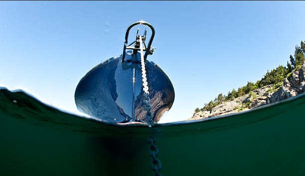
A boat that feels securely anchored at one point in the day may not be set up the same way several hours later. Along the East Coast, changing tide levels can alter water depth enough to affect the amount of rode your anchoring scope really needs. That makes the tide range more than a number on a forecast. It becomes an important part of planning where, when, and how you anchor. Misjudging it can leave too little scope at high water or create unexpected swing and spacing issues.
This article explains why changing tides deserve more attention and how they influence safer anchoring decisions.
Key Takeaways
- Calculate the rode length using the highest expected water level during the stay.
- Treat swing clearance and anchor holding as two separate safety checks.
- Review local tide, current, and weather conditions at every new anchorage.
6 Ways East Coast Tide Range Changes Safe Anchoring Scope
-
Rising Tide Changes Scope Calculations
The depth shown at arrival is only a starting point. A safe calculation also includes the bow roller’s height above the water and the predicted rise before high tide.
For example, 9 feet of water, 4 feet of bow height, and a 5-foot rise create an 18-foot working depth. At a 7-to-1 ratio, that means about 126 feet of anchor line. Basing the anchoring scope only on the first depth reading would underestimate what is needed later. Before anchoring, check the highest expected water level through NOAA tide predictions.
-
Wider Swing Reduces Clearance
As the boat moves around a fixed anchor, its path can extend toward docks, channel edges, shoals, moorings, or nearby vessels. The concern here is not simply how much rode is deployed, but whether the anchorage has enough room for the boat’s full movement.
Well-thought-out boating safety lessons should treat swing clearance as a separate check from scope calculation. Marking the anchor’s position on a chart helps estimate the area the boat may cover as the wind and current shift. A setup can be secure on the bottom and still be poorly placed if the surrounding space is too tight.
-
Tide Turns Reverse the Pull
Flood and ebb currents pull a boat in opposite directions. As the water turns, the rode may briefly soften before tightening again from a new angle, effectively giving the anchor another holding test.
A firm set in clean sand may handle that change smoothly. An anchor resting in grass, loose shell, or uneven ground may rotate or reset several feet away. Reviewing the anchoring scope after the turn helps confirm that the boat followed a normal arc rather than shifting unexpectedly. A fixed shoreline reference or chart plotter track can make the movement easier to spot. Checking NOAA current predictions can also help estimate when the flow is likely to change direction.
-
Peak Flow Tests Anchor Grip
Current strength changes throughout the tidal cycle. Even when the direction remains steady, faster-moving water places more pressure on the anchor, rode, cleats, and bow fittings.
That is why the initial set matters. Reliable anchoring techniques include lowering the anchor under control, easing the boat back, and gradually increasing reverse power. This gives the anchor time to dig instead of skipping across the seabed. Firm sand, soft mud, grass, and oyster shells do not provide equal grip under stronger flow conditions.
Hands-on beginner boating lessons can help boaters practice setting, checking, and recovering an anchor in real coastal conditions, where bottom response is easier to understand than in a diagram.
-
Coastal Geography Changes Tide Range
East Coast tides do not rise and fall equally at every stop. A narrow inlet, a broad bay, a tidal river, and a protected creek may each respond differently because local shoreline shape and underwater contours affect how water moves.
This variation matters during East Coast marine transport, especially when a vessel stops in unfamiliar waterways on consecutive nights. Rode used successfully in one harbor should not become the automatic choice at the next.
Every anchorage deserves a fresh check of predicted range, measured depth, and bow height. For longer relocations, Boat Transport Services may support vessel preparation and route coordination when a trip traverses multiple coastal environments with varying tidal behavior.
-
Weather Shifts Actual Water Levels
Tide tables describe predicted astronomical movement, but the water beside the boat may sit above or below that figure. Persistent onshore wind can push water toward the coast, while offshore wind may lower levels in certain harbors and rivers.
Atmospheric pressure, heavy rainfall, and river discharge can create further differences. Good navigation lessons encourage comparing predicted levels with observed conditions and the local forecast before settling in overnight. A modest safety allowance can help when actual water does not match the published table. For passages involving unfamiliar stops or changing coastal weather, yacht delivery may provide route planning and vessel repositioning support when the trip requires more experience than a routine local run.
Wrap Up
Safe East Coast anchoring is not about memorizing one ratio and using it everywhere. Rising water determines the rode required, adding line changes the movement area, a tide turn reverses the pull, and stronger flow tests the anchor’s grip. Geography and weather add separate variables that should be reviewed on their own.
Treating each factor as a distinct check prevents one safety concern from being confused with another. When the anchoring scope is planned for the full tidal cycle rather than the conditions visible at arrival, an overnight stop becomes steadier and more predictable.
FAQs
Should the scope use the high-tide depth?
Yes. Include the highest expected water level and the bow roller’s height above the surface.
Is more rode always safer?
No. It may improve the pull angle, but limited space can make the wider movement area unsafe.
Why does the tide range vary locally?
Coastline shape, water depth, rivers, inlets, and nearby shoals affect how tides behave.