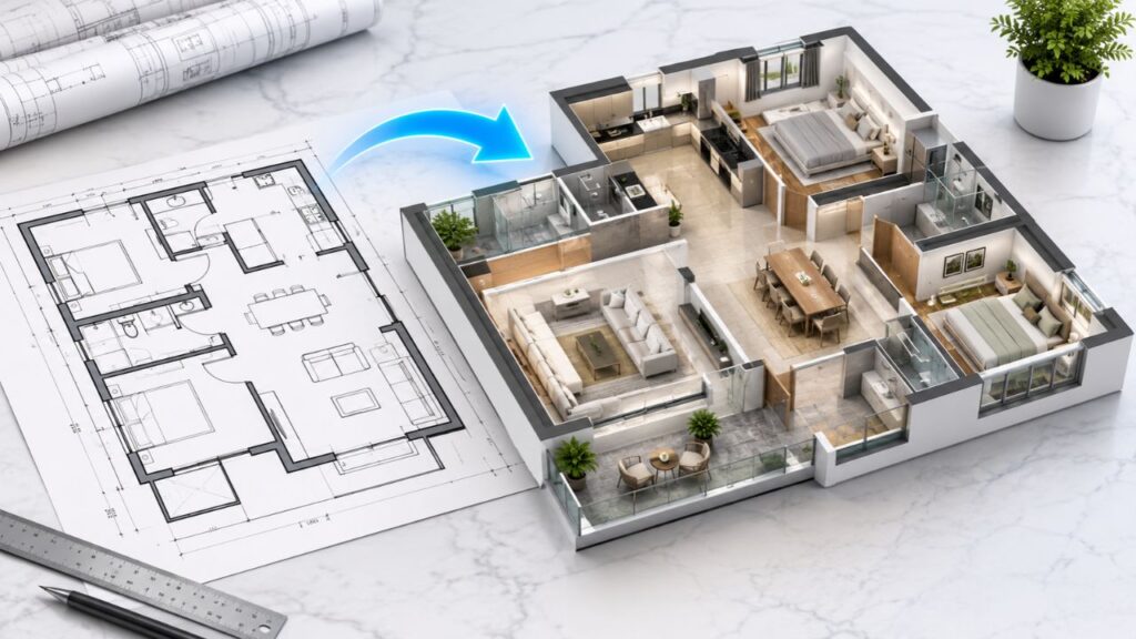
Two-dimensional floor plans have long served as the technical foundation of building design and architectural documentation. However, flat orthographic drawings often introduce spatial ambiguities between design intent and site execution. Converting static 2D floor plans into realistic, high-definition 3D visualizations resolves these communication gaps across every phase of the project lifecycle. For general contractors, architects, structural engineers, and commercial developers across the United States, adopting advanced three-dimensional spatial workflows minimizes field rework, accelerates client approvals, and ensures multi-trade alignment before ground breaks on-site.
Operational Limitations of Flat 2D Schematics
Navigating traditional multi-sheet drawing packages presents distinct coordination challenges during early pre-construction planning. Subcontractors frequently encounter hidden spatial conflicts when evaluating overlapping mechanical ductwork, structural steel frames, and custom interior millwork solely from plan views. These undetected design clashes lead to expensive field modification orders, material waste, and cascading schedule delays. Upgrading static CAD files into unified three-dimensional models eliminates these persistent blind spots before fabrication begins.
Step-by-Step 3D Spatial Conversion Workflow
Converting standard computer-aided design files into fully textured, photorealistic 3D models demands strict technical precision and parametric modeling protocols.
1. Vector Extraction and Parametric Geometry Setup
The conversion process begins by importing native DWG, DXF, or PDF floor plans into advanced building information modeling software. Draftsmen establish precise grid baselines, floor elevations, wall thicknesses, and structural openings according to original project specifications. Every wall, door, and window receives explicit height and vertical positioning parameters. Establishing this precise geometric foundation guarantees that all downstream architectural detailing and trade systems align without dimensional discrepancies.
2. Surface Material Mapping and Texture Realism
Raw spatial shapes require detailed surface treatments to achieve realistic visual depth. Modeling teams apply high-resolution material maps reflecting true-to-life physical characteristics, including polished concrete, structural masonry, architectural glass, and custom wood finishes. Advanced rendering engines process physical light behavior, generating accurate reflections, refractions, and surface textures. This spatial depth helps project owners and stakeholders evaluate interior flow, proportions, and aesthetic choices with complete confidence.
3. Integrating Reality Capture and Point-Cloud Scans
When executing renovation, retrofitting, or adaptive reuse projects, legacy 2D floor plans are often incomplete or outdated. Utilizing terrestrial laser scanners and reality capture devices generates dense 3D point-cloud data. Translating this raw spatial scan data directly into parametric models provides an exact baseline of existing structural conditions, allowing new architectural additions to integrate smoothly without unexpected field adjustments.
4. Environmental Lighting Analysis and Contextual Site Rendering
Accurate lighting simulation elevates a basic geometric model into an invaluable design and decision-making tool. Photometric engine configurations mimic exact geographic coordinates and sun angles across different times of day and seasons. Interior fixture placement highlights functional task areas, structural features, and circulation routes. Placing the model within its surrounding site topography delivers the complete environmental context required for local planning boards, regulatory reviews, and investor presentations.
Enhancing Collaboration, Pre-Leasing, and Field Execution
High-quality 3D visual models yield substantial commercial and operational benefits beyond preliminary design reviews. Real estate developers leverage photorealistic renders in marketing collateral to secure pre-leasing agreements and project financing months ahead of completion. On the job site, general contractors use 3D structural views during daily briefing sessions to clearly explain complex assembly sequences directly to field installation teams. Partnering with the specialized architectural and BIM drafting team at US Drafting Inc. allows engineering and construction firms to scale their visualization pipelines rapidly without expanding internal operational overhead.
Conclusion
Converting 2D floor plans into realistic 3D visualizations represents an essential operational step for modern construction management. Eliminating spatial ambiguity reduces field rework, streamlines client approvals, and simplifies multidisciplinary trade coordination. Standardizing a robust 3D visualization workflow positions architecture, engineering, and construction professionals to execute residential, commercial, and industrial projects with speed and technical precision.