Making good decisions sounds simple enough. Look at the information, understand what it means, and choose the best option. In the real world, though, things get messy pretty quickly. There are spreadsheets, reports, GPS data, images, field notes, customer information, and a dozen other things to deal with. This is where mapping data software becomes useful. Instead of looking at data as a pile of numbers, businesses can see where things are happening, how they connect, and what might happen next.
Turning Complicated Data Into Something Useful
Numbers on their own don’t always tell the full story. A spreadsheet might show that sales are dropping in a certain region, for example. That’s useful, but it doesn’t explain why.
Put that same information on a map, and suddenly there may be a pattern. Perhaps the affected areas are all farther away from distribution centers. Maybe they’re concentrated around a particular road network. Or there could be a competitor opening stores in those exact locations.
That’s the real advantage of location-based data. It adds context.
Mapping data software brings different datasets together and displays them visually. Depending on the industry, that could include property boundaries, infrastructure, customer locations, environmental information, transportation routes, or operational assets.
And honestly, seeing the problem is often half the battle.
Better Decisions Start With Better Visibility
One of the biggest problems businesses face is making decisions with incomplete information. People make assumptions. Sometimes those assumptions are right. Sometimes they’re very expensive.
Mapping tools help reduce that guesswork.
A logistics company can use geographic data to understand delivery routes and identify delays. A construction company can study terrain and site conditions before work starts. Utilities can track infrastructure and identify areas where maintenance may be needed.
The point isn’t just making a nice-looking map. That’s not enough.
The useful part is being able to analyze information spatially and spot relationships that might otherwise get missed. A location that looks fine in a spreadsheet can look completely different once it’s viewed alongside roads, elevation, population density, or existing infrastructure.
This gives managers something much more valuable than raw data: a clearer picture of what’s actually going on.
How Mapping Supports Faster Planning
Time matters in business. Waiting weeks for someone to collect information, organize it, and create a report can mean making decisions based on information that’s already out of date.
Modern mapping platforms can speed up that process considerably.
Teams can collect information from multiple sources and update maps as conditions change. Field workers can share observations from the ground. Managers sitting in an office can then see those updates without waiting for a stack of paperwork.
This is particularly useful when teams are spread across large areas.
A company managing hundreds of assets, for example, needs more than a basic database. It needs to know where those assets are, what condition they’re in, and how they relate to everything around them. A digital map makes that information much easier to understand.
The Role of Drone in a box Technology
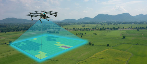
Things get even more interesting when mapping is combined with automated aerial data collection. A Drone in a box system can operate from a fixed location, launch when needed, capture imagery or other data, and return to its docking station.
That can make a major difference for industries where conditions change constantly.
Think about a construction site. Instead of relying entirely on manual inspections, aerial imagery can provide regular updates on progress. Mining operations can monitor large areas. Agriculture teams can identify changes across fields. Infrastructure operators can check difficult-to-reach locations.
The combination of aerial collection and mapping creates a much more current view of the environment.
A Drone in a box setup can also reduce the amount of routine fieldwork people have to do. That’s not about replacing people. It’s about keeping workers away from repetitive or potentially risky tasks where automation makes sense.
From Data Collection to Actual Action
Collecting more data isn’t automatically a good thing. Businesses already have plenty of data. The problem is often figuring out what to do with it.
That’s why mapping data software is valuable beyond basic visualization. Good platforms help turn collected information into something teams can actually act on.
For example, an operations manager might identify an area with repeated equipment failures. Once those incidents are plotted geographically, a pattern may appear. Maybe all the failures are close to a particular environmental condition or section of infrastructure.
Now there’s something to investigate.
The same principle applies to emergency response, land management, transportation, and urban planning. When people can understand both the information and its location, decisions tend to become more grounded.
Why Real-Time Information Matters
Old information can be worse than no information if people assume it’s still accurate.
Road conditions change. Construction moves forward. Equipment gets relocated. Weather affects terrain. New buildings appear. Customer behavior shifts.
A mapping system that can incorporate newer information gives decision-makers a better chance of responding to what is happening now, rather than what happened three months ago.
This is another reason businesses are moving toward connected mapping and automated data collection. A Drone in a box can gather fresh information, while mapping systems organize it into a format people can understand.
It creates a practical loop: collect, map, analyze, decide.
Not glamorous. Just useful.
Conclusion: Making Smarter Decisions With Location Data
Smart decision-making isn’t about having the biggest pile of data. It’s about understanding the data well enough to use it.
Mapping data software gives organizations that missing layer of context. It shows where problems are happening, reveals patterns, supports planning, and helps teams act with more confidence.
When combined with technologies such as a Drone in a box, the benefits can go even further. Organizations can collect current information from the field and turn it into useful geographic intelligence without relying entirely on manual processes.
There will always be uncertainty in business. No software can remove that completely. But better visibility can certainly reduce the amount of guessing involved. And when decisions have real costs attached to them, that’s a pretty big advantage.